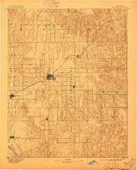
1892 Map of Coldwater
USGS Topo · Published 1896About this map
Coldwater serves as the central hub of this 1890s landscape, situated where the grid of early western settlement meets the rolling topography of southwestern Kansas. The Atchison Topeka and Santa Fe RR cuts a diagonal path across the terrain, linking the rail stops of Belvidere, Wilmore, and Protection. This survey captures the county before modern consolidation, showing a network of small, distinct communities such as Nescatunga and Avilla that were vital to the frontier agricultural economy. The drainage patterns of the Cimmaron River in the south and Bluff Creek in the west reveal the natural constraints that shaped local ranching and farming boundaries. The map also delineates early township divisions, including Shimer, Rumsey, and Powell, providing a clear look at the early civil organization of the region shortly after its initial survey.
Find a feature on this map
30 named features on this map. Tap any name to fly to it.
Don’t see what you’re looking for? This feature index may not catch every label — zoom into the map to look around manually.
Map Details
Editions of this 1892 Coldwater Map
5 editions found
Other maps of this area

1889 · Kinsley
USGS Topo · 1:125,000

1891 · Medicine Lodge
USGS Topo · 1:125,000

1892 · Kinsley
USGS Topo · 1:125,000

1892 · Spearville
USGS Topo · 1:125,000

1892 · Coldwater
USGS Topo · 1:125,000

1892 · Pratt
USGS Topo · 1:125,000

1893 · Medicine Lodge
USGS Topo · 1:125,000

1894 · Spearville
USGS Topo · 1:125,000

1894 · Kinsley
USGS Topo · 1:125,000

1894 · Pratt
USGS Topo · 1:125,000