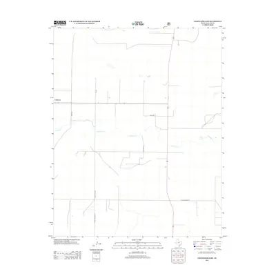
2012 Map of Coldwater East
USGS Topo · Published 2012About this map
Coldwater and its surrounding High Plains ranching landscape are defined by a sparse network of section-line roads and the intermittent drainage of Coldwater Cr. In this northern reaches of the Texas Panhandle, the settlement pattern is dictated by water and the vast distances between farmsteads. The winding path of Coldwater Cr provides a natural break in the geometric grid of agricultural roads, including FM 296 and French Rd. Significant local landmarks include Aqua Fria Spring, a critical water source in this semi-arid environment. The local naming conventions, seen in roads like School House Rd and the poetic W High Lonesome Ln, hint at the historic locations of rural educational centers and the isolated character of life in Dallam County during the early 21st century.
Find a feature on this map
10 named features on this map. Tap any name to fly to it.
Don’t see what you’re looking for? This feature index may not catch every label — zoom into the map to look around manually.
Map Details
Editions of this 2012 Coldwater East Map
This is the sole edition of this map. No revisions or reprints were ever made.
Other maps of this area

1954 · Dalhart
USGS Topo · 1:250,000

1958 · Dalhart
USGS Topo · 1:250,000

1962 · Dalhart
USGS Topo · 1:250,000

1969 · Boise City SW
USGS Topo · 1:24,000

1969 · Boise City SE
USGS Topo · 1:24,000

1971 · Conrad SW
USGS Topo · 1:24,000

1973 · Stratford 2 NW
USGS Topo · 1:24,000

1973 · Tovrea Ranch
USGS Topo · 1:24,000
1973 · Coldwater West
USGS Topo · 1:24,000

1973 · Coldwater East
USGS Topo · 1:24,000