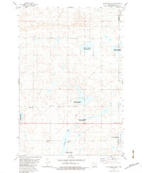
1982 Map of Coldwater Lake
USGS Topo · Published 1983About this map
Coldwater Lake dominates this McIntosh County landscape, surrounded by an extensive network of wetlands protected as the National Waterfowl Production Area. This 1982 survey illustrates a sparsely populated agrarian region where the township lines of German, Spring, and Albertha meet. Local history is anchored by rural landmarks such as Zion Ch and several burial sites including Bertsch Cems and the Cem of Salem. The shoreline of the lake features Coldwater Park and a Boat Ramp, providing public access to the water. Infrastructure in the area is minimal, noted by a scattered Gravel Pit and a utility Substa, reflecting the enduring rural character of the North Dakota prairie during the late twentieth century.
Find a feature on this map
15 named features on this map. Tap any name to fly to it.
Don’t see what you’re looking for? This feature index may not catch every label — zoom into the map to look around manually.
Map Details
Editions of this 1982 Coldwater Lake Map
This is the sole edition of this map. No revisions or reprints were ever made.
Other maps of this area

1896 · Edgeley
USGS Topo · 1:125,000

1899 · Ellendale
USGS Topo · 1:125,000

1925 · Edgeley
USGS Topo · 1:125,000

1953 · Jamestown
USGS Topo · 1:250,000

1954 · Aberdeen
USGS Topo · 1:250,000

1956 · Aberdeen
USGS Topo · 1:250,000

1956 · Jamestown
USGS Topo · 1:250,000

1968 · Long Lake NW
USGS Topo · 1:24,000

1968 · Long Lake NE
USGS Topo · 1:24,000
1968 · Forbes NW
USGS Topo · 1:24,000
Featured Places
- German Township, ND
- Albertha Township, ND
- Spring Valley Township, ND
- McIntosh County, ND
- Dickey County, ND