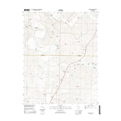
2015 Map of Coldwater
USGS Topo · Published 2015About this map
Saint Francis River dominates the western landscape of this Missouri Ozarks terrain, winding past notable crossings such as Varsh Ford and Shelton Ford. The map records the rural settlements of Saco, Coldwater, and Lodi, which are interspersed among the elevations of the Saint Francois Mountains. Numerous small family and community burial grounds, including Whitener Cemetery, Paullus Cemetery, and Linville-Barrett Cemetery, provide significant data for genealogical research within Madison and Wayne Counties. The drainage patterns are intricate, defined by Trace Cr, Twelvemile Cr, and Cedar Cr which feed into the larger river system. Significant peaks and ridges like Bald Knob, Victoria Mtn, and Mt Glory rise above dozens of named hollows, illustrating the dissected topography that has historically shaped local transport and settlement patterns.
Find a feature on this map
91 named features on this map. Tap any name to fly to it.
Don’t see what you’re looking for? This feature index may not catch every label — zoom into the map to look around manually.
Map Details
Editions of this 2015 Coldwater Map
This is the sole edition of this map. No revisions or reprints were ever made.
Other maps of this area

1926 · Des Arc
USGS Topo · 1:62,500

1929 · Des Arc
USGS Topo · 1:62,500

1930 · Coldwater
USGS Topo · 1:62,500

1932 · Piedmont
USGS Topo · 1:62,500

1934 · Greenville
USGS Topo · 1:62,500

1935 · Piedmont
USGS Topo · 1:62,500

1939 · Greenville
USGS Topo · 1:62,500

1949 · Rolla
USGS Topo · 1:250,000

1949 · Coldwater
USGS Topo · 1:62,500

1953 · Rolla
USGS Topo · 1:250,000