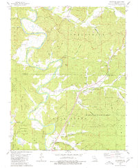
1980 Map of Coldwater
USGS Topo · Published 1980About this map
The St Francis River carves a winding path through this corner of the Ozarks, defining the boundary between the Liberty and St Francis townships. The landscape is a network of named hollows and ridges, with high points like Bald Knob and Strahl Mountain overlooking the river valley. The community of Coldwater sits at the junction of several drainage systems, including Wakefield Creek and Cedar Creek, serving as a central point in this rural landscape.
Find a feature on this map
67 named features on this map. Tap any name to fly to it.
Don’t see what you’re looking for? This feature index may not catch every label — zoom into the map to look around manually.
Map Details
Editions of this 1980 Coldwater Map
This is the sole edition of this map. No revisions or reprints were ever made.
Other maps of this area

1926 · Des Arc
USGS Topo · 1:62,500

1929 · Des Arc
USGS Topo · 1:62,500

1930 · Coldwater
USGS Topo · 1:62,500

1932 · Piedmont
USGS Topo · 1:62,500

1934 · Greenville
USGS Topo · 1:62,500

1935 · Piedmont
USGS Topo · 1:62,500

1939 · Greenville
USGS Topo · 1:62,500

1949 · Rolla
USGS Topo · 1:250,000

1949 · Coldwater
USGS Topo · 1:62,500

1953 · Rolla
USGS Topo · 1:250,000