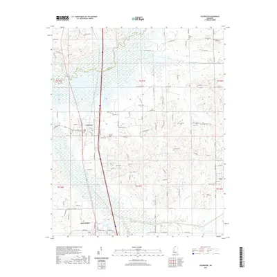
2021 Map of Coldwater
USGS Topo · Published 2021About this map
The Coldwater River and its wide floodplain define the geography between Coldwater and Senatobia in this contemporary documentation of northern Mississippi. The map highlights a landscape heavily marked by local heritage, featuring a high density of small cemeteries such as Magnolia Cem, Scotland Cem, and the Pritchard Cem. These burial grounds, often located near rural churches like Palestine Ch and Edwards Chapel, provide a detailed record of family landholdings and community centers that have persisted through generations in Tate and DeSoto counties. To the west, the reach of Arkabutla Lake underscores the importance of water management in this river-bottom terrain. The settlement patterns follow the high ground away from Beartail Creek and Hickahala Creek, where established roads like Old Coldwater Rd connect scattered homesteads and agricultural tracts.
Find a feature on this map
110 named features on this map. Tap any name to fly to it.
Don’t see what you’re looking for? This feature index may not catch every label — zoom into the map to look around manually.
Map Details
Editions of this 2021 Coldwater Map
This is the sole edition of this map. No revisions or reprints were ever made.
Other maps of this area

1932 · Horn Lake
USGS Topo · 1:48,000

1932 · Crenshaw
USGS Topo · 1:62,500

1935 · Crenshaw
USGS Topo · 1:62,500

1935 · Horn Lake
USGS Topo · 1:62,500

1944 · Senatobia
USGS Topo · 1:62,500

1944 · Hernando
USGS Topo · 1:62,500

1948 · Helena
USGS Topo · 1:250,000

1950 · Helena
USGS Topo · 1:250,000

1955 · Helena
USGS Topo · 1:250,000

1956 · Tupelo
USGS Topo · 1:250,000