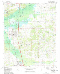
1982 Map of Coldwater
USGS Topo · Published 1982About this map
Arkabutla Lake dominates the western edge of this Tate County landscape, where the Coldwater River and Hickahala Creek converge. The town of Coldwater sits at a crossroads of commerce and history, defined by its position along the Illinois Central Gulf railroad and the proximity to the reservoir's flood control areas. Further south, the community of Senatobia is home to the Northwest Mississippi Junior College, showing the growth of this educational hub by the early 1980s.
Find a feature on this map
60 named features on this map. Tap any name to fly to it.
Don’t see what you’re looking for? This feature index may not catch every label — zoom into the map to look around manually.
Map Details
Editions of this 1982 Coldwater Map
This is the sole edition of this map. No revisions or reprints were ever made.
Other maps of this area

1932 · Horn Lake
USGS Topo · 1:48,000

1932 · Crenshaw
USGS Topo · 1:62,500

1935 · Crenshaw
USGS Topo · 1:62,500

1935 · Horn Lake
USGS Topo · 1:62,500

1944 · Senatobia
USGS Topo · 1:62,500

1944 · Hernando
USGS Topo · 1:62,500

1948 · Helena
USGS Topo · 1:250,000

1950 · Helena
USGS Topo · 1:250,000

1955 · Helena
USGS Topo · 1:250,000

1956 · Tupelo
USGS Topo · 1:250,000