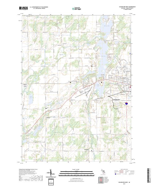
2023 Map of Coldwater West
USGS Topo · Published 2023About this map
Coldwater serves as the central hub on this Branch County survey, where the Branch County Courthouse stands as a landmark of local civic history. The landscape is defined by its glacial hydrology, featuring a dense network of lakes including Morrison Lake, North Lake, and South Lake, which feed the southern progression of the Coldwater River. The settlement pattern follows the early terrestrial routes westward, with the smaller communities of Batavia and Batavia Center situated along the historic Chicago Road corridor. Rural burial grounds like Oak Grove Cem and Batavia Cem are scattered throughout the township lines, providing valuable points of reference for genealogical research. The presence of the Branch County Memorial Airport and various named heights such as Pilot Knob and Hawk Hill offer a clear picture of the modern topography and transport infrastructure in this southern Michigan region.
Find a feature on this map
123 named features on this map. Tap any name to fly to it.
Don’t see what you’re looking for? This feature index may not catch every label — zoom into the map to look around manually.
Map Details
Editions of this 2023 Coldwater West Map
This is the sole edition of this map. No revisions or reprints were ever made.
Other maps of this area

1918 · Union City
USGS Topo · 1:62,500

1947 · Union City
USGS Topo · 1:62,500

1948 · Homer
USGS Topo · 1:62,500

1949 · Homer
USGS Topo · 1:62,500

1950 · Union City
USGS Topo · 1:62,500

1953 · Fort Wayne
USGS Topo · 1:250,000

1956 · Fort Wayne
USGS Topo · 1:250,000

1958 · Grand Rapids
USGS Topo · 1:250,000

1960 · Coldwater West
USGS Topo · 1:24,000

1960 · Coldwater East
USGS Topo · 1:24,000