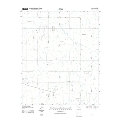
2013 Map of Cole
USGS Topo · Published 2013About this map
The settlement of Cole serves as the primary hub in this portion of McClain County, surrounded by a landscape defined by significant petroleum exploration and agricultural water management. The map documents an extensive network of energy infrastructure, including the North Dibble Oil Field, Washington Oil Field, and the Iron Chapel Oil Field. This concentration of industrial activity is interspersed with rural landmarks like the Dibble Cem, providing a clear view of the intersection between local genealogy and regional industry. Water resources are central to the terrain, with Walnut Cr, Buffalo Cr, and Dibble Cr cutting through the section lines, while the Ken Dannels Reservoir in the southeast indicates modern water storage efforts. The grid of country roads, from MacArthur Ave to 200th St, illustrates the persistent township-and-range settlement pattern of central Oklahoma.
Find a feature on this map
37 named features on this map. Tap any name to fly to it.
Don’t see what you’re looking for? This feature index may not catch every label — zoom into the map to look around manually.
Map Details
Editions of this 2013 Cole Map
This is the sole edition of this map. No revisions or reprints were ever made.
Other maps of this area

1893 · Norman
USGS Topo · 1:62,500

1898 · Purcell
USGS Topo · 1:125,000

1898 · Pauls Valley
USGS Topo · 1:125,000

1902 · Pauls Valley
USGS Topo · 1:125,000

1902 · Rush Springs
USGS Topo · 1:125,000

1904 · Chickasha
USGS Topo · 1:125,000

1925 · Norman NO 2
USGS Topo · 1:24,000

1936 · Norman
USGS Topo · 1:62,500

1954 · Oklahoma City
USGS Topo · 1:250,000

1957 · Ardmore
USGS Topo · 1:250,000