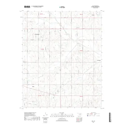
2018 Map of Cole
USGS Topo · Published 2018About this map
Cole and the eastern edge of Blanchard anchor this 2018 survey of McClain County, where the transition from rolling prairie to the creek bottoms of Walnut Creek is clearly defined. The landscape is dominated by a grid of rural roads and scattered farmsteads, punctuated by historic resting places like Jerusalem Cem and Dibble Cem. To the southeast, the small community of Washington sits near the headwaters of several drainage systems, while the southwestern corner features Dibble and the winding course of Dibble Creek. Modern water management is evident through numerous reservoirs, including the Ken Daniels Reservoir and 087035 Reservoir, reflecting the area's agricultural reliance on local watersheds like Sandy Creek and North Criner Creek. The map documents a contemporary rural Oklahoma landscape where traditional townships like Goldsby continue to interface with a maturing network of county roads.
Find a feature on this map
47 named features on this map. Tap any name to fly to it.
Don’t see what you’re looking for? This feature index may not catch every label — zoom into the map to look around manually.
Map Details
Editions of this 2018 Cole Map
This is the sole edition of this map. No revisions or reprints were ever made.
Other maps of this area

1893 · Norman
USGS Topo · 1:62,500

1898 · Purcell
USGS Topo · 1:125,000

1898 · Pauls Valley
USGS Topo · 1:125,000

1902 · Pauls Valley
USGS Topo · 1:125,000

1902 · Rush Springs
USGS Topo · 1:125,000

1904 · Chickasha
USGS Topo · 1:125,000

1925 · Norman NO 2
USGS Topo · 1:24,000

1936 · Norman
USGS Topo · 1:62,500

1954 · Oklahoma City
USGS Topo · 1:250,000

1957 · Ardmore
USGS Topo · 1:250,000