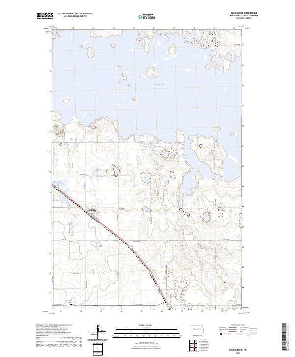
2024 Map of Coleharbor
USGS Topo · Published 2024About this map
Coleharbor serves as the central hub of this McLean County landscape, positioned along a transportation corridor that bridges the gap between the prairie uplands and the expansive waters of Audubon Lake. The geography is defined by the managed wetlands and protected habitats of the Audubon National Wildlife Refuge, which dominates the northern and eastern portions of the map. Historically significant for local families, the Coleharbor Cem is located south of the main settlement, providing a fixed point for genealogical research. The terrain is marked by the winding path of Wolf Creek and a rigid grid of rural roads, including Co Hwy 12 and Co Rd 15, which reflect the organized agricultural land use of the North Dakota plains. The map illustrates a balance between human habitation and large-scale conservation efforts, showing how the local infrastructure accommodates the irregular shoreline created by the lake.
Find a feature on this map
26 named features on this map. Tap any name to fly to it.
Don’t see what you’re looking for? This feature index may not catch every label — zoom into the map to look around manually.
Map Details
Editions of this 2024 Coleharbor Map
This is the sole edition of this map. No revisions or reprints were ever made.
Other maps of this area

1922 · Garrison
USGS Topo · 1:62,500

1929 · Coleharbor
USGS Topo · 1:62,500

1948 · Stanton
USGS Topo · 1:62,500

1949 · Stanton
USGS Topo · 1:62,500

1949 · Washburn
USGS Topo · 1:62,500

1954 · McClusky
USGS Topo · 1:250,000

1958 · McClusky
USGS Topo · 1:250,000

1961 · Lake Nettie
USGS Topo · 1:24,000

1961 · Washburn NE
USGS Topo · 1:24,000

1961 · Underwood
USGS Topo · 1:24,000