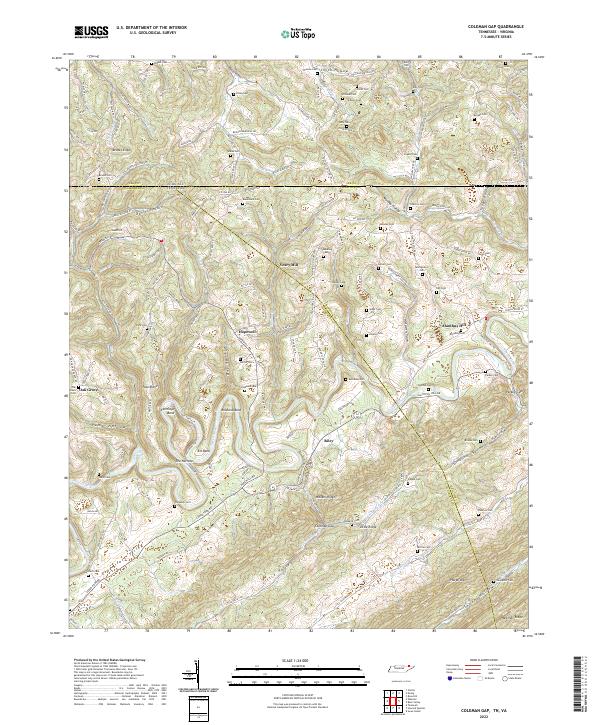
2022 Map of Coleman Gap
USGS Topo · Published 2022About this map
The Powell River snakes through the Appalachian borderland, carving sharp horseshoe loops at Rowland Bend and Elk Bend before tightening at The Narrows. This landscape is defined by its deep ridges and hollows, where small settlements like Hopewell and Riley sit along the winding valley floors. The transition from Virginia to Tennessee is marked by the rugged crest of Brooks Ridge and the southern slopes of Wallens Ridge, which meet at the topographic saddle of Coleman Gap.
Find a feature on this map
159 named features on this map. Tap any name to fly to it.
Don’t see what you’re looking for? This feature index may not catch every label — zoom into the map to look around manually.
Map Details
Editions of this 2022 Coleman Gap Map
This is the sole edition of this map. No revisions or reprints were ever made.
Other maps of this area

1883 · Morristown
USGS Topo · 1:125,000

1886 · Cumberland Gap
USGS Topo · 1:125,000

1887 · Jonesville
USGS Topo · 1:125,000

1888 · Cumberland Gap
USGS Topo · 1:125,000

1891 · Cumberland Gap
USGS Topo · 1:125,000

1891 · Jonesville
USGS Topo · 1:125,000

1893 · Morristown
USGS Topo · 1:125,000

1895 · Morristown
USGS Topo · 1:125,000

1897 · Maynardville
USGS Topo · 1:125,000

1900 · Maynardville
USGS Topo · 1:125,000