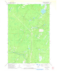
1972 Map of Coleman Lake
USGS Topo · Published 1974About this map
The Peshtigo River carves through the southwestern corner of this Marinette County landscape, marked by natural features like Strong Falls and Taylor Rapids. Public land and recreation are central to the area's layout, anchored by the Goodman County Park and the prominent Goodman Lookout Tower situated to the north. The terrain is defined by a complex network of glacial lakes and waterways, including the large Coleman Lake and the South Branch Pike River.
Find a feature on this map
39 named features on this map. Tap any name to fly to it.
Don’t see what you’re looking for? This feature index may not catch every label — zoom into the map to look around manually.
Map Details
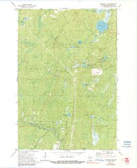
Editions of this 1972 Coleman Lake Map
2 editions found
Other maps of this area

1939 · Dunbar
USGS Topo · 1:48,000

1939 · Goodman
USGS Topo · 1:48,000

1940 · Thunder Mtn.
USGS Topo · 1:48,000

1940 · Athelstane
USGS Topo · 1:48,000

1941 · Dunbar
USGS Topo · 1:48,000

1942 · Athelstane
USGS Topo · 1:48,000

1946 · Goodman
USGS Topo · 1:48,000

1947 · Dunbar
USGS Topo · 1:48,000

1951 · Thunder Mountain
USGS Topo · 1:48,000

1954 · Iron Mountain
USGS Topo · 1:250,000