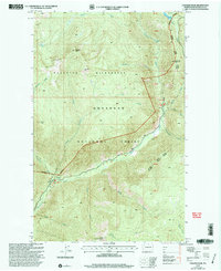
2001 Map of Coleman Peak
USGS Topo · Published 2004About this map
Pasayten Wilderness and the Okanogan National Forest dominate this high-elevation terrain in northern Washington, centered on the prominent Coleman Peak. The landscape is defined by the deep valley of the Chewuch River, which flows past the Thirtymile settlement and down toward Chewuch Falls. Surveyors and fire lookouts utilized high vantage points like Thirtymile Peak and the Twentymile Peak Lookout to monitor these timbered reaches. A network of mountain drainages, including Andrews Creek, Meadow Creek, and Sheep Creek, carve through the ridges, while alpine features like Tonseth Lake and Meadow Lake occupy the upper basins. This map illustrates the intersection of primitive wilderness protection and active national forest management at the turn of the millennium, documenting the trails and forest roads providing access to the Methow-Tonasket Ranger District.
Find a feature on this map
44 named features on this map. Tap any name to fly to it.
Don’t see what you’re looking for? This feature index may not catch every label — zoom into the map to look around manually.
Map Details
Editions of this 2001 Coleman Peak Map
This is the sole edition of this map. No revisions or reprints were ever made.
Other maps of this area

1906 · Chopaka
USGS Topo · 1:125,000

1954 · Okanogan
USGS Topo · 1:250,000

1955 · Concrete
USGS Topo · 1:250,000

1956 · Tiffany Mountain
USGS Topo · 1:62,500

1956 · Horseshoe Basin
USGS Topo · 1:62,500

1958 · Concrete
USGS Topo · 1:250,000

1958 · Okanogan
USGS Topo · 1:250,000

1962 · Concrete
USGS Topo · 1:250,000

1963 · Doe Mountain
USGS Topo · 1:62,500

1969 · Mt. Barney
USGS Topo · 1:24,000