
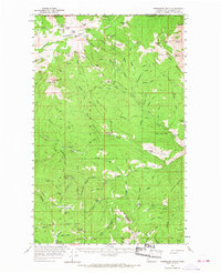
1956 Map of Horseshoe Basin
USGS Topo · Published 1959About this map
Okanogan Mountains and the international boundary with Canada define this high-elevation landscape as it appeared in the mid-1950s. The area is characterized by a dense network of pack trails and seasonal camps, reflecting a wilderness economy of grazing and forestry. Horseshoe Basin serves as a central geographic feature, surrounded by prominent peaks such as Arnold Peak and Snowshoe Mtn. The proliferation of named camps, including Louden Camp, Coyote Camp, and Lone Wolf Camp, suggests the importance of this region for backcountry access and livestock management within the Okanogan National Forest.
Find a feature on this map
108 named features on this map. Tap any name to fly to it.
Don’t see what you’re looking for? This feature index may not catch every label — zoom into the map to look around manually.
Map Details
Editions of this 1956 Horseshoe Basin Map
3 editions found
Other maps of this area

1906 · Chopaka
USGS Topo · 1:125,000

1954 · Okanogan
USGS Topo · 1:250,000

1955 · Concrete
USGS Topo · 1:250,000

1956 · Loomis
USGS Topo · 1:62,500

1956 · Tiffany Mountain
USGS Topo · 1:62,500

1957 · Conconully
USGS Topo · 1:62,500

1958 · Concrete
USGS Topo · 1:250,000

1958 · Okanogan
USGS Topo · 1:250,000

1962 · Concrete
USGS Topo · 1:250,000

1963 · Doe Mountain
USGS Topo · 1:62,500