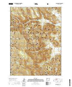
2020 Map of Coleman Point
USGS Topo · Published 2020About this map
Fremont National Forest dominates this landscape in southern Oregon, characterized by the dramatic rise of Coleman Rim and the volcanic prominence of Coleman Point. The terrain is defined by a series of high-altitude flats, such as Picture Flat and Lantern Flat, which provide a contrast to the steep drainage systems of Dairy Cr and Morgan Cr. The area’s hydrology is primarily seasonal, with numerous named water sources including Eagle Spring and Grasshopper Spring providing vital points of reference in an otherwise arid timberland. A network of Forest Service roads, including NATL Forest Develop Road 3675 Rd, provides access for land management and recreation, including the seasonal Quartz Mtn Snowmobile Trail (Snow) that traverses the northwestern slopes.
Find a feature on this map
49 named features on this map. Tap any name to fly to it.
Don’t see what you’re looking for? This feature index may not catch every label — zoom into the map to look around manually.
Map Details
Editions of this 2020 Coleman Point Map
This is the sole edition of this map. No revisions or reprints were ever made.
Other maps of this area

1955 · Klamath Falls
USGS Topo · 1:250,000

1958 · Klamath Falls
USGS Topo · 1:250,000

1960 · Fishhole Mtn
USGS Topo · 1:62,500

1964 · Cox Flat
USGS Topo · 1:24,000

1964 · Coleman Point
USGS Topo · 1:24,000

1964 · Cougar Peak
USGS Topo · 1:24,000

1964 · Shoestring Butte
USGS Topo · 1:24,000

1966 · Morgan Butte
USGS Topo · 1:24,000

1966 · Coffeepot Creek
USGS Topo · 1:24,000

1966 · Lee Thomas Crossing
USGS Topo · 1:24,000