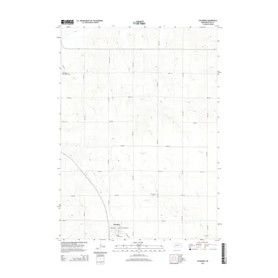
2014 Map of Coleridge
USGS Topo · Published 2014About this map
Coleridge serves as the primary hub in this portion of Cedar County, situated at the junction of Highway 57 and several local routes like E Broadway St. The surrounding landscape is defined by the dendritic drainage patterns of several tributaries, including Dead Cr and N Logan Cr, which carve through the agricultural terrain. For those researching local heritage, the map identifies key burial sites such as Saint Michael Cem on the outskirts of the main settlement and Immanuel Cem further north along 568th Ave. The northwestern corner of the quadrangle is marked by the Hartington Municipal Airport, providing a modern transport link to this rural region. The grid of section roads, from 881st Rd down to 875th Rd, illustrates the highly organized land division characteristic of the Great Plains, where every mile of prairie is integrated into a larger network of farm-to-market access.
Find a feature on this map
30 named features on this map. Tap any name to fly to it.
Don’t see what you’re looking for? This feature index may not catch every label — zoom into the map to look around manually.
Map Details
Editions of this 2014 Coleridge Map
This is the sole edition of this map. No revisions or reprints were ever made.
Other maps of this area

1955 · Sioux City
USGS Topo · 1:250,000

1958 · Sioux City
USGS Topo · 1:250,000

1959 · Sioux City
USGS Topo · 1:250,000

1968 · Obert
USGS Topo · 1:24,000

1968 · Coleridge
USGS Topo · 1:24,000

1968 · Hartington
USGS Topo · 1:24,000

1968 · Wynot
USGS Topo · 1:24,000
1968 · Coleridge SE
USGS Topo · 1:24,000

1968 · Fordyce
USGS Topo · 1:24,000
1971 · Laurel
USGS Topo · 1:24,000