2021 Map of Coleridge
USGS Topo · Published 2021About this map
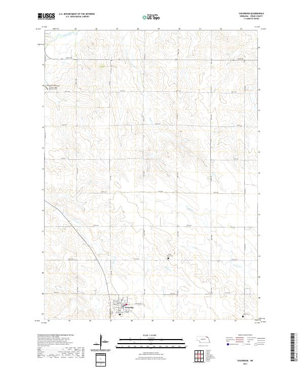
The agricultural village of Coleridge serves as the focal point of this Cedar County landscape, where the grid-based township and range system dictates the movement of people and water. Organized around a core of streets including W Broadway St and E Douglas St, the town is surrounded by a dense network of numbered rural roads that crisscross the drainage basins of Bow Creek, Dead Cr, and Kerloo Cr. Local history and genealogy are preserved in several distinct sites, notably the Saint Michael Cem on the edge of town, and more remote burial grounds like Lawn Ridge Cem and Norris Cem. The northern portion of the map highlights the Hartington Municipal Airport/ Bud Becker Field, illustrating the infrastructure supporting this corner of northeast Nebraska.
Find a feature on this map
37 named features on this map. Tap any name to fly to it.
Don’t see what you’re looking for? This feature index may not catch every label — zoom into the map to look around manually.
Map Details
Editions of this 2021 Coleridge Map
This is the sole edition of this map. No revisions or reprints were ever made.