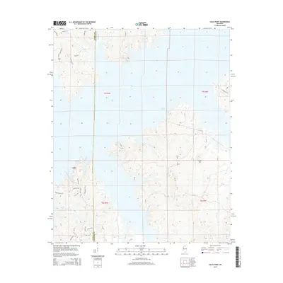
2015 Map of Coles Point
USGS Topo · Published 2015About this map
Sardis Lake dominates this Mississippi landscape, its sprawling shoreline creating a complex system of peninsulas and inlets across the borders of Lafayette and Panola Counties. The settlement at Coles Point serves as a primary landmark for this lakeside region, which is defined by the intersection of water and winding local roads. The terrain rises to notable elevations at Carter Mtn, while the drainage system of Greasy Cr and Nelson Cr feeds the reservoir.
Find a feature on this map
14 named features on this map. Tap any name to fly to it.
Don’t see what you’re looking for? This feature index may not catch every label — zoom into the map to look around manually.
Map Details
Editions of this 2015 Coles Point Map
This is the sole edition of this map. No revisions or reprints were ever made.
Other maps of this area

1940 · Oxford
USGS Topo · 1:62,500

1943 · Oxford
USGS Topo · 1:62,500

1944 · Senatobia
USGS Topo · 1:62,500

1944 · Tyro
USGS Topo · 1:62,500

1952 · Sardis
USGS Topo · 1:62,500

1953 · Sardis
USGS Topo · 1:62,500

1956 · Tupelo
USGS Topo · 1:250,000

1958 · Tupelo
USGS Topo · 1:250,000

1971 · Laws Hill
USGS Topo · 1:24,000
1971 · Tyro
USGS Topo · 1:24,000