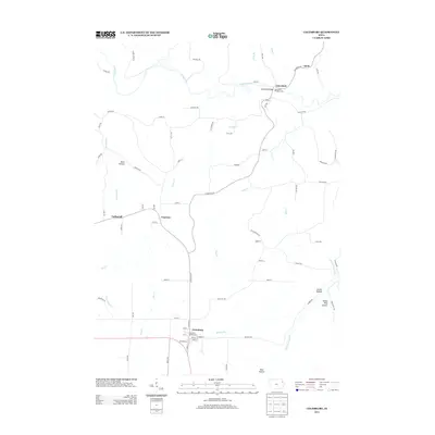
2013 Map of Colesburg
USGS Topo · Published 2013About this map
The Turkey River and Little Turkey River dominate the landscape of northeast Iowa, carving a network of deep drainages such as Devils Hollow and White Pine Hollow. In the southern portion of the quadrangle, the community of Colesburg serves as a local hub, featuring the Lone Pine Golf Course and a defined street grid near the intersection of several county roads. The terrain is marked by significant elevation changes, with drainage basins like Bloody Run and Pine Cr feeding the larger river systems.
Find a feature on this map
75 named features on this map. Tap any name to fly to it.
Don’t see what you’re looking for? This feature index may not catch every label — zoom into the map to look around manually.
Map Details
Editions of this 2013 Colesburg Map
This is the sole edition of this map. No revisions or reprints were ever made.
Other maps of this area

1902 · Elkader
USGS Topo · 1:125,000

1957 · Turkey River
USGS Topo · 1:24,000

1957 · Colesburg
USGS Topo · 1:24,000

1959 · Dubuque
USGS Topo · 1:250,000

1961 · Dubuque
USGS Topo · 1:250,000

1962 · Dubuque
USGS Topo · 1:250,000
1962 · New Vienna
USGS Topo · 1:24,000
1962 · Garnavillo
USGS Topo · 1:24,000

1962 · Petersburg
USGS Topo · 1:24,000
1962 · Guttenberg
USGS Topo · 1:24,000