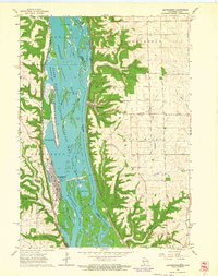
1962 Map of Guttenberg
USGS Topo · Published 1964About this map
The Mississippi River dominates this early 1960s landscape, serving as the fluid border between Clayton County, Iowa, and Grant County, Wisconsin. The river's industrial and ecological role is evident through the massive Lock and Dam No 10 at Guttenberg and the sprawling Upper Mississippi River Wildlife and Fish Refuge that covers the complex network of sloughs and islands. On the Iowa side, the Chicago Milwaukee St Paul and Pacific railroad hugs the shoreline, while the Wisconsin bank is traced by the Chicago Burlington and Quincy line, reflecting a time when rail and river traffic were the primary pulses of the region.
Find a feature on this map
41 named features on this map. Tap any name to fly to it.
Don’t see what you’re looking for? This feature index may not catch every label — zoom into the map to look around manually.
Map Details
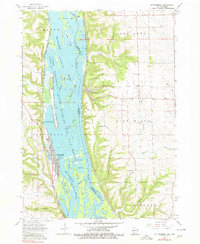
Editions of this 1962 Guttenberg Map
2 editions found
Other maps of this area

1900 · Lancaster
USGS Topo · 1:125,000

1902 · Elkader
USGS Topo · 1:125,000

1904 · Lancaster
USGS Topo · 1:125,000

1908 · Lancaster
USGS Topo · 1:125,000

1955 · Cassville
USGS Topo · 1:24,000

1957 · Turkey River
USGS Topo · 1:24,000

1957 · Colesburg
USGS Topo · 1:24,000

1959 · Dubuque
USGS Topo · 1:250,000

1961 · Dubuque
USGS Topo · 1:250,000

1962 · Dubuque
USGS Topo · 1:250,000