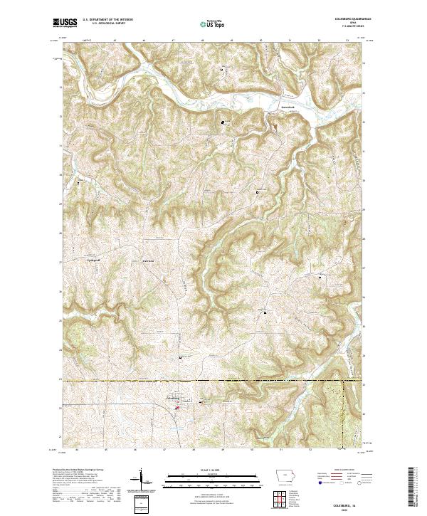
2022 Map of Colesburg
USGS Topo · Published 2022About this map
Turkey River winds through the northern reaches of this landscape where the borders of Clayton, Delaware, and Dubuque counties converge. The settlement of Osterdock serves as a focal point near the river, while further south, Colesburg marks a significant crossroads near the headwaters of Bloody Run. The terrain is defined by its deep drainages, including Devils Hollow and White Pine Hollow, which illustrate the erosion patterns characteristic of this corner of Iowa. This area is notably dense with small family and community burial grounds, such as Lewis Cem, Koenig Cem, and Noggle Cem, offering a detailed map of the region's genealogical footprint. Smaller hamlets like Fairview and Updegraff are linked by a network of rural routes, including Co Hwy C53 and Co Hwy X41, showing the persistence of these early agricultural communities into the modern era.
Find a feature on this map
78 named features on this map. Tap any name to fly to it.
Don’t see what you’re looking for? This feature index may not catch every label — zoom into the map to look around manually.
Map Details
Editions of this 2022 Colesburg Map
This is the sole edition of this map. No revisions or reprints were ever made.
Other maps of this area

1902 · Elkader
USGS Topo · 1:125,000

1957 · Turkey River
USGS Topo · 1:24,000

1957 · Colesburg
USGS Topo · 1:24,000

1959 · Dubuque
USGS Topo · 1:250,000

1961 · Dubuque
USGS Topo · 1:250,000

1962 · Dubuque
USGS Topo · 1:250,000
1962 · New Vienna
USGS Topo · 1:24,000
1962 · Garnavillo
USGS Topo · 1:24,000

1962 · Petersburg
USGS Topo · 1:24,000
1962 · Guttenberg
USGS Topo · 1:24,000