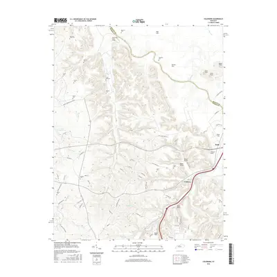
2016 Map of Colesburg
USGS Topo · Published 2016About this map
Colesburg serves as a central hub in this landscape where the Bullitt and Hardin county lines meet along the winding path of the Rolling Fork river. The area is characterized by a high concentration of family and community burial grounds, such as Patterson Chapel Cem, Williams Cem, and the Cedar Creek Cem, which offer significant touchpoints for genealogical research. The road network reflects both historical river crossings and modern military proximity, featuring the Wooldridge Ferry Bridge and the Seventh Armored Division Rd. Numerous hollows and flats, including Brewer Hollow and Harned Flats, define the drainage patterns of several creeks like Clear Creek and Sulphur Br that feed into the larger river system, illustrating the complex topography of this Kentucky region.
Find a feature on this map
82 named features on this map. Tap any name to fly to it.
Don’t see what you’re looking for? This feature index may not catch every label — zoom into the map to look around manually.
Map Details
Editions of this 2016 Colesburg Map
This is the sole edition of this map. No revisions or reprints were ever made.
Other maps of this area

1935 · Elizabethtown
USGS Topo · 1:48,000

1936 · Vine Grove
USGS Topo · 1:62,500

1938 · Elizabethtown
USGS Topo · 1:62,500

1943 · Vine Grove
USGS Topo · 1:62,500

1946 · Pitts Point
USGS Topo · 1:24,000

1946 · Fort Knox
USGS Topo · 1:24,000

1946 · Colesburg
USGS Topo · 1:24,000

1946 · Vine Grove
USGS Topo · 1:24,000

1946 · Vine Grove
USGS Topo · 1:62,500

1948 · Cecilia
USGS Topo · 1:24,000