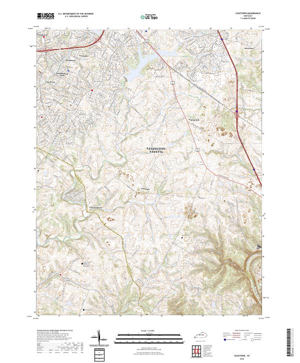
2022 Map of Coletown
USGS Topo · Published 2022About this map
Lexington-Fayette expands toward the southeastern reaches of the Bluegrass region, where suburban developments like Gainesway and Southeastern Hills meet the long-established rural topography of the county. The landscape is defined by the winding course of E Hickman Cr and Shelby Br, carving through the limestone terrain toward the Kentucky River. Small, historically significant settlements such as Coletown, Walnut Hill, and East Hickman provide a view into the area's agricultural past, as residential streets begin to replace farmland along Tates Creek Rd and Old Richmond Rd. Genealogists will find several family burial grounds preserved among the hills, including the Taylor Family Farm Cem and McNeil Cem. The transition from the urban density of Lansdowne to the steep bluffs of Blacksmith Ridge illustrates the distinct geographic divide between the plateau and the river valley.
Find a feature on this map
41 named features on this map. Tap any name to fly to it.
Don’t see what you’re looking for? This feature index may not catch every label — zoom into the map to look around manually.
Map Details
Editions of this 2022 Coletown Map
This is the sole edition of this map. No revisions or reprints were ever made.
Other maps of this area

1892 · Richmond
USGS Topo · 1:125,000

1897 · Richmond
USGS Topo · 1:125,000

1905 · Harrodsburg
USGS Topo · 1:125,000

1906 · Georgetown
USGS Topo · 1:62,500

1908 · Georgetown
USGS Topo · 1:62,500

1927 · Lexington
USGS Topo · 1:48,000

1929 · Lexington
USGS Topo · 1:62,500

1950 · Lexington East
USGS Topo · 1:24,000

1950 · Lexington West
USGS Topo · 1:24,000

1952 · Valley View
USGS Topo · 1:24,000