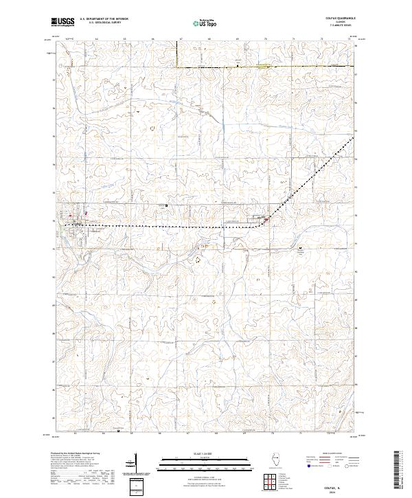
1986 Map of Colfax
USGS Topo · Published 1986About this map
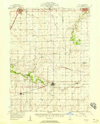
Colfax and Anchor stand as the primary centers of settlement on this Central Illinois prairie landscape in the mid-1980s. The terrain is defined by the gentle drainage of the Mackinaw River and Henline Creek, which carve subtle paths through the expansive agricultural townships of Lawndale, Cropsey, Martin, and Anchor. The map documents the political boundary between Livingston Co and Mc Lean Co, reflecting the long-established surveyor's grid that continues to dictate road patterns and land use in this part of McLean County. Small, unnamed cemeteries are scattered across the quadrangle, serving as markers of the rural population centers and family farming history that shaped the region during its development. In the town of Colfax, municipal infrastructure such as a Sewage Disposal Plant is noted, signifying the growth and modernization of these rural communities by the late twentieth century.
Find a feature on this map
12 named features on this map. Tap any name to fly to it.
Don’t see what you’re looking for? This feature index may not catch every label — zoom into the map to look around manually.
Map Details
Editions of this 1986 Colfax Map
This is the sole edition of this map. No revisions or reprints were ever made.
Historical Maps of Colfax Through Time
7 maps found