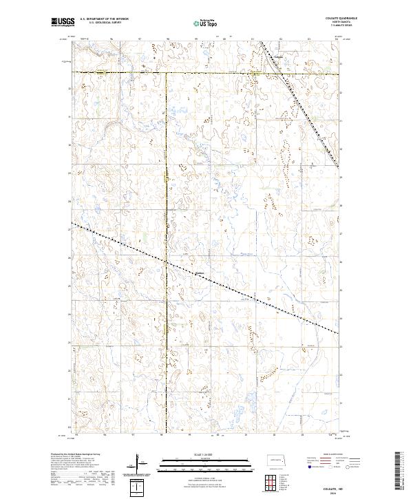
2024 Map of Colgate
USGS Topo · Published 2024About this map
Maple River meanders across this rural North Dakota landscape, crossing through the borderlands where Steele, Barnes, and Cass Counties meet. This agricultural region is anchored by the small settlements of Colgate in the northeast and Walden to the south. The terrain is defined by the section-line grid of the Public Land Survey System, with an extensive network of rural routes such as Co Rd 2, Co Hwy 6, and Co Rd 26 providing access to the sprawling farmsteads. The path of the Maple River provides a rare natural break in the geometric regularity of the prairie, creating a corridor of wetlands and varying elevations amidst the productive fields. This survey captures the enduring rural character of the eastern plains as it exists in the early twenty-first century.
Find a feature on this map
22 named features on this map. Tap any name to fly to it.
Don’t see what you’re looking for? This feature index may not catch every label — zoom into the map to look around manually.
Map Details
Editions of this 2024 Colgate Map
This is the sole edition of this map. No revisions or reprints were ever made.
Other maps of this area

1952 · Grand Forks
USGS Topo · 1:250,000

1956 · Grand Forks
USGS Topo · 1:250,000

1966 · Grand Forks
USGS Topo · 1:250,000

1966 · Hope SE
USGS Topo · 1:24,000

1967 · Pillsbury SE
USGS Topo · 1:24,000

1967 · Page SE
USGS Topo · 1:24,000

1967 · Page
USGS Topo · 1:24,000
1967 · Pillsbury
USGS Topo · 1:24,000
1967 · Page SW
USGS Topo · 1:24,000

1967 · Colgate
USGS Topo · 1:24,000
Featured Places
- Colgate Township, ND
- Carpenter Township, ND
- Minnie Lake Township, ND
- Ellsbury Township, ND
- Lake Township, ND