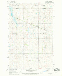
1967 Map of Pillsbury
USGS Topo · Published 1969About this map
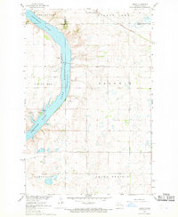
Pillsbury serves as the primary hub of this eastern North Dakota prairie, anchored by the Great Northern rail line that cuts diagonally across the landscape. The terrain is defined by its glacial heritage, featuring a complex network of depressions and water bodies including Willow Lake, Goose Lake, and Minnie Lake. These features are set against the large surveying blocks of Grand Prairie, Ellsbury, Baldwin, and Carpenter.
Find a feature on this map
13 named features on this map. Tap any name to fly to it.
Don’t see what you’re looking for? This feature index may not catch every label — zoom into the map to look around manually.
Map Details
Editions of this 1967 Pillsbury Map
This is the sole edition of this map. No revisions or reprints were ever made.
Other maps of this area

1952 · Grand Forks
USGS Topo · 1:250,000

1956 · Grand Forks
USGS Topo · 1:250,000

1966 · Grand Forks
USGS Topo · 1:250,000

1967 · Pillsbury SE
USGS Topo · 1:24,000
1967 · Pillsbury SW
USGS Topo · 1:24,000
1967 · Luverne
USGS Topo · 1:24,000
1967 · Page SW
USGS Topo · 1:24,000

1967 · Colgate
USGS Topo · 1:24,000
1967 · Sibley
USGS Topo · 1:24,000

1967 · Luverne SE
USGS Topo · 1:24,000
Featured Places
- Pillsbury, ND
- Baldwin Township, ND
- Ellsbury Township, ND
- Minnie Lake Township, ND
- Grand Prairie Township, ND