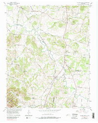
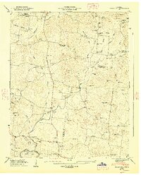
1957 Map of College Grove
USGS Topo · Published 1989About this map
Louisville and Nashville tracks establish a central corridor through this Tennessee landscape, connecting the rural communities of Arrington, McDaniel, and College Grove. The terrain is defined by the winding course of the Harpeth River and a series of prominent elevations like Patton Knob and Yancey Knob. This mid-century survey reveals a high density of country churches and schools that anchored local life, from the Kirkland Sch to Wesley Chapel.
Find a feature on this map
55 named features on this map. Tap any name to fly to it.
Don’t see what you’re looking for? This feature index may not catch every label — zoom into the map to look around manually.
Map Details
Editions of this 1957 College Grove Map
4 editions found
Other maps of this area

1909 · Franklin
USGS Topo · 1:62,500

1936 · Chapel Hill
USGS Topo · 1:24,000

1936 · Rover
USGS Topo · 1:24,000

1936 · Rally Hill
USGS Topo · 1:24,000

1936 · Bethesda
USGS Topo · 1:24,000

1942 · Lebanon
USGS Topo · 1:100,000

1944 · Shelbyville
USGS Topo · 1:100,000

1946 · Bethesda
USGS Topo · 1:24,000
1947 · Rally Hill
USGS Topo · 1:24,000

1949 · Franklin
USGS Topo · 1:24,000