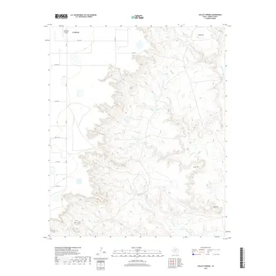
2019 Map of Collett Springs
USGS Topo · Published 2019About this map
The city of Crosbyton sits at the edge of the Llano Estacado, where the flat plains suddenly drop into the breaks of the White River valley. This 2019 survey captures a landscape defined by dramatic topographical relief, as water has carved deep drainage systems such as Sand Rock Cr and Blue Hole Cr into the escarpment. These geological features create a distinct contrast between the developed townsite and the complex canyonlands to the east. Several named landmarks rise above the drainage basins, including Indian Hill, Cedar Hill, and Negro Hill. Water management for cattle ranching is evident through the placement of basins like Big Bull Tank, Rock Trail Tank, and Davidson Tank. The eastern boundary of the map follows the course of the White River, punctuated by the eponymous Collett Springs, while the Crosbyton Municipal Airport serves the local aviation needs of this Crosby County hub.
Find a feature on this map
24 named features on this map. Tap any name to fly to it.
Don’t see what you’re looking for? This feature index may not catch every label — zoom into the map to look around manually.
Map Details
Editions of this 2019 Collett Springs Map
This is the sole edition of this map. No revisions or reprints were ever made.
Other maps of this area

1954 · Lubbock
USGS Topo · 1:250,000

1961 · Bunker Hill
USGS Topo · 1:24,000

1962 · Smith Tank
USGS Topo · 1:24,000

1966 · Crosbyton
USGS Topo · 1:24,000

1966 · Kalgary
USGS Topo · 1:24,000

1966 · McAdoo
USGS Topo · 1:24,000

1966 · Collett Springs
USGS Topo · 1:24,000

1966 · Canyon Valley
USGS Topo · 1:24,000

1967 · Ralls SE
USGS Topo · 1:24,000

1967 · Ralls NE
USGS Topo · 1:24,000