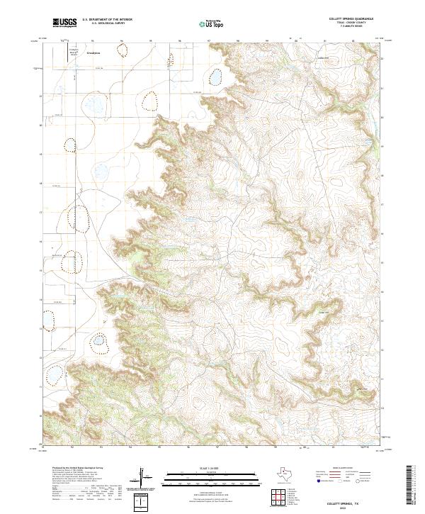
2022 Map of Collett Springs
USGS Topo · Published 2022About this map
Crosbyton occupies the northwest corner of this West Texas landscape, where the flat agricultural plains of the Llano Estacado meet the dramatic breaks and canyons of the Caprock Escarpment. The edge of the city is marked by the Crosbyton Municipal Airport and a network of rural roads such as FM 651 and Ranch Rd 40. Moving east, the terrain drops away into a complex system of draws and drainages, including Blue Hole Cr, Yankee Cr, and Sand Rock Cr.
Find a feature on this map
24 named features on this map. Tap any name to fly to it.
Don’t see what you’re looking for? This feature index may not catch every label — zoom into the map to look around manually.
Map Details
Editions of this 2022 Collett Springs Map
This is the sole edition of this map. No revisions or reprints were ever made.
Other maps of this area

1954 · Lubbock
USGS Topo · 1:250,000

1961 · Bunker Hill
USGS Topo · 1:24,000

1962 · Smith Tank
USGS Topo · 1:24,000

1966 · Crosbyton
USGS Topo · 1:24,000

1966 · Kalgary
USGS Topo · 1:24,000

1966 · McAdoo
USGS Topo · 1:24,000

1966 · Collett Springs
USGS Topo · 1:24,000

1966 · Canyon Valley
USGS Topo · 1:24,000

1967 · Ralls SE
USGS Topo · 1:24,000

1967 · Ralls NE
USGS Topo · 1:24,000