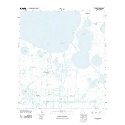
2012 Map of Collicon Lake
USGS Topo · Published 2012About this map
Mermentau Lake and Collicon Lake dominate this coastal Louisiana landscape, illustrating a complex web of wetlands and waterways. The map documents the extensive industrial infrastructure of the region, featuring the Pecan Lake Gas Field, Twin Island Oil Field, and the South Pecan Lake Oil and Gas Field. These energy resources are situated within a delicate ecosystem of bayous and chenieres, including Southwest Bayou and the ridge of Cheniere du Fond.
Find a feature on this map
26 named features on this map. Tap any name to fly to it.
Don’t see what you’re looking for? This feature index may not catch every label — zoom into the map to look around manually.
Map Details
Editions of this 2012 Collicon Lake Map
This is the sole edition of this map. No revisions or reprints were ever made.
Other maps of this area

1932 · Constance Bayou NE
USGS Topo · 1:31,680

1932 · Constance Bayou NW
USGS Topo · 1:31,680

1934 · Catfish Lake
USGS Topo · 1:24,000

1934 · Latania Lake
USGS Topo · 1:24,000

1935 · Catfish Lake
USGS Topo · 1:31,680

1935 · Latania Lake
USGS Topo · 1:31,680

1946 · Hog Bayou NE
USGS Topo · 1:31,680

1949 · Hog Bayou NE
USGS Topo · 1:31,680

1954 · Grand Lake East NW
USGS Topo · 1:31,680

1954 · Grand Lake East SE
USGS Topo · 1:31,680