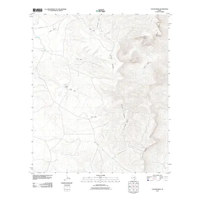
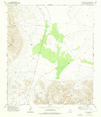
2011 Map of Collier Mesa
USGS Topo · Published 2011About this map
Sierra Diablo dominates the landscape in this remote Trans-Pecos region, where high desert elevations and deep drainages define the human footprint. The map documents the isolated McAdoo Ranch situated near the head of Collier Draw, illustrating the extreme spacing of pastoral settlements in the West Texas scrub. The eastern portion of the quadrangle is defined by the steep escarpment of the Diablo Rim, where the terrain drops sharply into Victorio Canyon and its northern branch, Little Victorio Canyon. Water management is vital in this arid environment, evidenced by livestock watering features like Cedar Tank and Dusty Tank. The distribution of these man-made tanks and named intermittent watercourses such as Dusty Draw and Cave Draw provides a clear view of how ranching operations utilized the natural topography of Collier Mesa in the early 21st century.
Find a feature on this map
14 named features on this map. Tap any name to fly to it.
Don’t see what you’re looking for? This feature index may not catch every label — zoom into the map to look around manually.
Map Details
Editions of this 2011 Collier Mesa Map
This is the sole edition of this map. No revisions or reprints were ever made.
Other maps of this area

1895 · Sierra Blanca
USGS Topo · 1:125,000

1906 · Van Horn
USGS Topo · 1:125,000

1954 · Van Horn
USGS Topo · 1:250,000

1958 · Van Horn
USGS Topo · 1:250,000
1964 · Sheep Peak
USGS Topo · 1:24,000
1964 · Nutt Ranch
USGS Topo · 1:24,000
1964 · Bean Hills
USGS Topo · 1:24,000

1973 · Sneed Mountain NE
USGS Topo · 1:24,000
1973 · Victorio Peak
USGS Topo · 1:24,000

1973 · Apache Peak
USGS Topo · 1:24,000