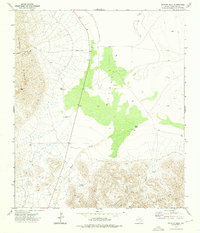
1973 Map of Victorio Peak
USGS Topo · Published 1976About this map
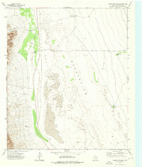
The Sierra Diablo range dominates the western horizon of this Culberson County landscape, rising sharply above the desert floor. This 1973 survey captures a remote ranching environment defined by vital water sources like Victorio Well, North Well, and the seasonal Baylor Pond. The presence of the Corn Ranch and the Victorio Canyon Jeep Trail suggests the rugged infrastructure required to navigate the canyons and peaks of the Baylor Mountains to the south. A prominent green-shaded depression marks the central basin, highlighting the stark contrast between the high summits of Victorio Peak and the low-lying Baylor Draw. Researchers will find a meticulously detailed record of the catchment tanks and wells that sustained high-desert life and industry in the decades following the mid-century.
Find a feature on this map
15 named features on this map. Tap any name to fly to it.
Don’t see what you’re looking for? This feature index may not catch every label — zoom into the map to look around manually.
Map Details
Editions of this 1973 Victorio Peak Map
This is the sole edition of this map. No revisions or reprints were ever made.
Other maps of this area

1906 · Van Horn
USGS Topo · 1:125,000

1954 · Van Horn
USGS Topo · 1:250,000

1958 · Van Horn
USGS Topo · 1:250,000

1964 · Watson Ranch
USGS Topo · 1:24,000
1964 · Sheep Peak
USGS Topo · 1:24,000
1964 · Nutt Ranch
USGS Topo · 1:24,000

1972 · Square Mesa
USGS Topo · 1:24,000

1973 · Apache Peak
USGS Topo · 1:24,000
1973 · Seven Heart Gap NW
USGS Topo · 1:24,000
1973 · Figure Two Ranch
USGS Topo · 1:24,000