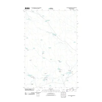
2011 Map of Collins Reservoir
USGS Topo · Published 2011About this map
Collins Ranch serves as a primary landmark in this ranchland region of Valley County, characterized by an extensive system of small-scale water management. The landscape is defined by dozens of local impoundments such as Mosquito Reservoir, Skull Reservoir, and the centrally located Collins Reservoir. These numerous named catchments and dams, including the distinctively titled Thingamajig Dam and Gutshot Dam, reveal the essential infrastructure required to support livestock and agriculture in this dry Montana climate. Natural drainages like Lone Tree Creek and South Fork Beaver Creek dictate the placement of these reservoirs. The road network, featuring Triple Cross Access Rd and Willow Creek Rd, connects these isolated water sources and ranching outposts, illustrating the sparse but organized settlement pattern of the early 21st century.
Find a feature on this map
48 named features on this map. Tap any name to fly to it.
Don’t see what you’re looking for? This feature index may not catch every label — zoom into the map to look around manually.
Map Details
Editions of this 2011 Collins Reservoir Map
This is the sole edition of this map. No revisions or reprints were ever made.
Other maps of this area

1943 · Glasgow
USGS Topo · 1:125,000

1954 · Jordan
USGS Topo · 1:250,000

1954 · Glasgow
USGS Topo · 1:250,000

1956 · Jordan
USGS Topo · 1:250,000

1957 · Glasgow
USGS Topo · 1:250,000

1958 · Glasgow
USGS Topo · 1:250,000

1958 · Jordan
USGS Topo · 1:250,000

1958 · Miller Coulee
USGS Topo · 1:62,500

1958 · Collins Ranch
USGS Topo · 1:62,500

1964 · Jordan
USGS Topo · 1:250,000