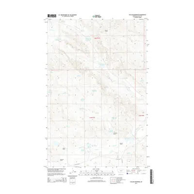
2014 Map of Collins Reservoir
USGS Topo · Published 2014About this map
Collins Reservoir and a high density of small water catchment systems define this section of Valley County, Montana. The landscape is carved by a network of drainage channels such as Pearson Coulee and White Rock Coulee, which feed into larger arteries like Willow Creek. This map reveals a specific ranching or land-management strategy of the early 21st century, where dozens of named reservoirs—including Your Name Reservoir, Lush Reservoir, and Three Trees Reservoir—are distributed across the townships of T26N R37E and T25N R37E. The terrain transition is marked by features like Roosevelt Coulee and Corral Coulee, illustrating the complex local topography used for water retention in this arid region.
Find a feature on this map
40 named features on this map. Tap any name to fly to it.
Don’t see what you’re looking for? This feature index may not catch every label — zoom into the map to look around manually.
Map Details
Editions of this 2014 Collins Reservoir Map
This is the sole edition of this map. No revisions or reprints were ever made.
Other maps of this area

1943 · Glasgow
USGS Topo · 1:125,000

1954 · Jordan
USGS Topo · 1:250,000

1954 · Glasgow
USGS Topo · 1:250,000

1956 · Jordan
USGS Topo · 1:250,000

1957 · Glasgow
USGS Topo · 1:250,000

1958 · Glasgow
USGS Topo · 1:250,000

1958 · Jordan
USGS Topo · 1:250,000

1958 · Miller Coulee
USGS Topo · 1:62,500

1958 · Collins Ranch
USGS Topo · 1:62,500

1964 · Jordan
USGS Topo · 1:250,000