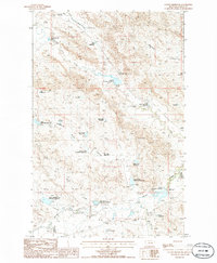
1985 Map of Collins Reservoir
USGS Topo · Published 1986About this map
Willow Creek and the South Fork Little Beaver Creek define this landscape in Valley County, where water management is the primary marker of human presence. The terrain is characterized by an extensive system of detention basins and small reservoirs designed to catch runoff in this semi-arid region. From the humorously named Your Name Reservoir and Mosquito Reservoir to the more literal Short Creek Detention Reservoir, these features reveal the engineering efforts required to support ranching operations like the Collins Ranch. Narrow coulees such as White Rock Coulee and Corral Coulee segment the area, illustrating the natural drainage patterns that dictate the placement of improvements like the Corral Junction No 2 Detention Reservoir. This 1980s-era topography provides a detailed view of how localized water control shaped the practical geography of northeastern Montana.
Find a feature on this map
35 named features on this map. Tap any name to fly to it.
Don’t see what you’re looking for? This feature index may not catch every label — zoom into the map to look around manually.
Map Details
Editions of this 1985 Collins Reservoir Map
This is the sole edition of this map. No revisions or reprints were ever made.
Other maps of this area

1943 · Glasgow
USGS Topo · 1:125,000

1954 · Jordan
USGS Topo · 1:250,000

1954 · Glasgow
USGS Topo · 1:250,000

1956 · Jordan
USGS Topo · 1:250,000

1957 · Glasgow
USGS Topo · 1:250,000

1958 · Glasgow
USGS Topo · 1:250,000

1958 · Jordan
USGS Topo · 1:250,000

1958 · Miller Coulee
USGS Topo · 1:62,500

1958 · Collins Ranch
USGS Topo · 1:62,500

1964 · Jordan
USGS Topo · 1:250,000