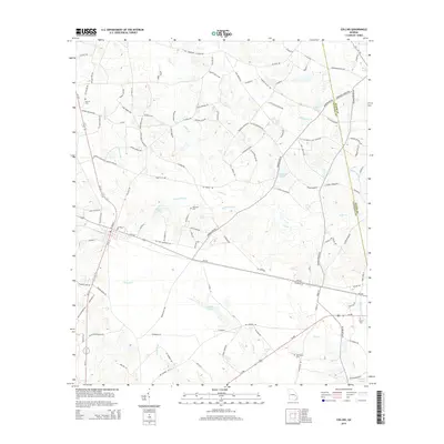
2014 Map of Collins
USGS Topo · Published 2014About this map
Collins serves as the central hub of this South Georgia landscape, where a grid of rural roads and highways extends into the surrounding wetlands and timberlands. The geography is defined by an intricate network of slow-moving waters, including Cedar Cr, Thomas Cr, and the expansive Cypress Flat Cr. These waterways are punctuated by numerous small basins and family-named landmarks such as Harris Lake and Dixon Lake. For those researching local lineages, the map records several significant burial sites, including the Old Tippins Cem and Tippins Cem near the southeast corner, along with the Wilkinson Cem and Rewis Cem further north. The boundary between Tattnall Co and Evans Co cuts through the eastern portion of the quadrangle, illustrating how political lines bisect the natural drainage of Water Hole Cr and Bull Cr.
Find a feature on this map
116 named features on this map. Tap any name to fly to it.
Don’t see what you’re looking for? This feature index may not catch every label — zoom into the map to look around manually.
Map Details
Editions of this 2014 Collins Map
This is the sole edition of this map. No revisions or reprints were ever made.
Other maps of this area

1919 · Claxton
USGS Topo · 1:62,500

1920 · Statesboro
USGS Topo · 1:62,500

1943 · Statesboro
USGS Topo · 1:62,500

1944 · Claxton
USGS Topo · 1:62,500

1947 · Savannah
USGS Topo · 1:250,000

1948 · Savannah
USGS Topo · 1:250,000

1950 · Claxton
USGS Topo · 1:62,500

1957 · Macon
USGS Topo · 1:250,000

1957 · Savannah
USGS Topo · 1:250,000

1958 · Macon
USGS Topo · 1:250,000