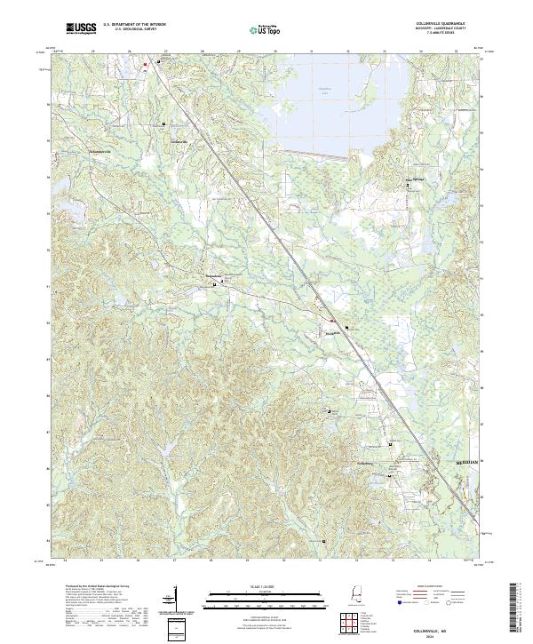
2024 Map of Collinsville
USGS Topo · Published 2024About this map
Okatibbee Lake dominates the northern landscape of this Lauderdale County region, where the waters of Okatibbee Creek and Twitley Branch converge. The area is defined by a series of small, established communities connected by a network of local roads like Old Hwy 19 S and Old Hwy 494. Local history is anchored by numerous spiritual and memorial sites, including the Collinsville Methodist Church and the Macedonia Baptist Church. Genealogists will find a high concentration of burial grounds such as Cedar Grove Cem, West Mount Moriah Cem, and Beason Cem, which serve as markers for the families who settled this territory between Suqualena and Nellieburg. The terrain is characterized by the winding paths of Suqualena Creek and Harper Creek, which drain into the lowlands near the Meridian boundary.
Find a feature on this map
100 named features on this map. Tap any name to fly to it.
Don’t see what you’re looking for? This feature index may not catch every label — zoom into the map to look around manually.
Map Details
Editions of this 2024 Collinsville Map
This is the sole edition of this map. No revisions or reprints were ever made.
Other maps of this area

1921 · Meridian
USGS Topo · 1:48,000

1923 · Meridian
USGS Topo · 1:62,500

1953 · Meridian
USGS Topo · 1:250,000

1957 · Meridian
USGS Topo · 1:250,000

1957 · Chunky
USGS Topo · 1:62,500

1962 · Daleville
USGS Topo · 1:24,000

1962 · Center Hill
USGS Topo · 1:24,000

1962 · Post
USGS Topo · 1:24,000

1965 · Meridian
USGS Topo · 1:250,000

1971 · Meridian South
USGS Topo · 1:24,000