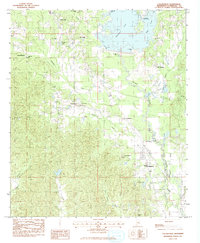
1983 Map of Collinsville
USGS Topo · Published 1983About this map
Collinsville and the surrounding woodlands of Lauderdale County are defined by the expansive waters of Okatibbee Lake in the early 1980s. This survey illustrates the landscape after the impoundment of Okatibbee Creek, which created a series of recreation areas including West Bank Park, East Bank Park, and the Okatibbee Water Park. The map provides a detailed view of the rural infrastructure connecting smaller settlements such as Suqualena, Hookston, and Nellieburg.
Find a feature on this map
41 named features on this map. Tap any name to fly to it.
Don’t see what you’re looking for? This feature index may not catch every label — zoom into the map to look around manually.
Map Details
Editions of this 1983 Collinsville Map
This is the sole edition of this map. No revisions or reprints were ever made.
Other maps of this area

1921 · Meridian
USGS Topo · 1:48,000

1923 · Meridian
USGS Topo · 1:62,500

1953 · Meridian
USGS Topo · 1:250,000

1957 · Meridian
USGS Topo · 1:250,000

1957 · Chunky
USGS Topo · 1:62,500

1962 · Daleville
USGS Topo · 1:24,000

1962 · Center Hill
USGS Topo · 1:24,000

1962 · Post
USGS Topo · 1:24,000

1965 · Meridian
USGS Topo · 1:250,000

1971 · Meridian South
USGS Topo · 1:24,000