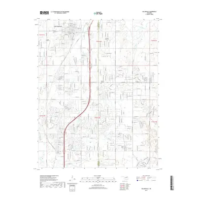
2019 Map of Collinsville
USGS Topo · Published 2019About this map
Collinsville serves as the primary municipal hub in this northeastern Oklahoma landscape, where the urban grid meets the expansive plains of Tulsa Co and Rogers Co. The map documents a territory defined by its transition from organized town streets to a vast network of section roads and drainage systems. Aviation plays a significant role in the local infrastructure, with specialized facilities such as Ragtime Aerodrome, Sandridge Airpark Inc, and Gundys Airport scattered across the landscape. The hydraulic character of the region is shaped by the Caney River to the north and the Owasso Lake area to the south, connected by numerous creeks including Blackjack Cr and Elm Cr. Genealogists will find notable burial grounds well-documented, including Ridgelawn Cem in the heart of town and the outlying Sand Ridge Cem.
Find a feature on this map
100 named features on this map. Tap any name to fly to it.
Don’t see what you’re looking for? This feature index may not catch every label — zoom into the map to look around manually.
Map Details
Editions of this 2019 Collinsville Map
This is the sole edition of this map. No revisions or reprints were ever made.
Other maps of this area

1901 · Claremore
USGS Topo · 1:125,000

1914 · Claremore
USGS Topo · 1:125,000

1916 · Claremore
USGS Topo · 1:125,000

1954 · Tulsa
USGS Topo · 1:250,000

1954 · Tulsa
USGS Topo · 1:24,000

1955 · Sperry
USGS Topo · 1:24,000

1955 · Mingo
USGS Topo · 1:24,000

1956 · Collinsville
USGS Topo · 1:24,000

1958 · Tulsa
USGS Topo · 1:250,000

1959 · Collinsville NE
USGS Topo · 1:24,000