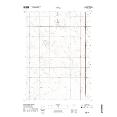
2017 Map of Colman
USGS Topo · Published 2017About this map
The Coteau des Prairies plateau defines the geography of this Moody County landscape, where the small city of Colman sits as a central hub for the surrounding agricultural township. This 2017 survey documents a high density of rural burial grounds that preserve the area's genealogical record, including Saint Peter's Cem to the north and the West Baptist Memorial Cem in the south. The natural drainage of the prairie is marked by the winding course of Bachelor Cr, which flows toward the southeast, and scattered water bodies like Poison Lake and Mud Lake. The grid-based road network, featuring routes such as Co HWY 77 and Co HWY O, illustrates the systematic development of the South Dakota plains, connecting isolated farmsteads and historic family-named landmarks across the sections.
Find a feature on this map
30 named features on this map. Tap any name to fly to it.
Don’t see what you’re looking for? This feature index may not catch every label — zoom into the map to look around manually.
Map Details
Editions of this 2017 Colman Map
This is the sole edition of this map. No revisions or reprints were ever made.
Other maps of this area

1953 · Watertown
USGS Topo · 1:250,000

1955 · Sioux Falls
USGS Topo · 1:250,000

1958 · Sioux Falls
USGS Topo · 1:250,000

1958 · Watertown
USGS Topo · 1:250,000

1962 · Colton SE
USGS Topo · 1:24,000

1962 · Dell Rapids
USGS Topo · 1:24,000

1963 · Trent
USGS Topo · 1:24,000

1963 · Colman
USGS Topo · 1:24,000

1964 · Rutland SE
USGS Topo · 1:24,000

1964 · Flandreau SW
USGS Topo · 1:24,000