
1922 Map of Colockum Pass
USGS Topo · Published 1922About this map
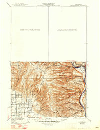
The Wenatchee Mountains and the high ridge of Colockum Pass dominate this 1920s-era landscape, where the rugged terrain of eastern Washington drops toward the banks of the Columbia River. The map reveals a remote ranching and rural agricultural economy, punctuated by isolated schools such as the Tarpiscan School and Whisky Dick School. Numerous family-named homesteads including the Sheridan Ranch and Osborn Ranch are clustered near the vital water sources of Colockum Creek and Naneum Creek.
Find a feature on this map
51 named features on this map. Tap any name to fly to it.
Don’t see what you’re looking for? This feature index may not catch every label — zoom into the map to look around manually.
Map Details
Editions of this 1922 Colockum Pass Map
2 editions found
Other maps of this area

1897 · Mount Stuart
USGS Topo · 1:125,000

1899 · Ellensburg
USGS Topo · 1:125,000

1901 · Chelan
USGS Topo · 1:125,000

1901 · Ellensburg
USGS Topo · 1:125,000

1901 · Chiwaukum
USGS Topo · 1:125,000

1902 · Mount Stuart
USGS Topo · 1:125,000

1904 · Chiwaukum
USGS Topo · 1:125,000

1909 · Quincy
USGS Topo · 1:62,500

1910 · Quincy
USGS Topo · 1:62,500

1912 · Beverly
USGS Topo · 1:62,500