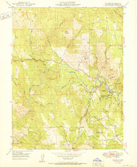
1950 Map of Coloma
USGS Topo · Published 1950About this map
The South Fork American River carves a deep valley through this El Dorado County landscape, centered on the foundational site of the California Gold Rush. In the village of Coloma, the Gold Discovery Site State Park and Sutters Mill (Site) represent the 1848 discovery that transformed the American West. Just south, the James W Marshall State Historical Monument stands on a ridge overlooking the river and the settlement of Lotus.
Find a feature on this map
46 named features on this map. Tap any name to fly to it.
Don’t see what you’re looking for? This feature index may not catch every label — zoom into the map to look around manually.
Map Details
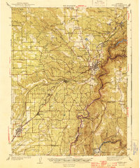
Editions of this 1950 Coloma Map
This is the sole edition of this map. No revisions or reprints were ever made.
Other maps of this area

1891 · Sacramento
USGS Topo · 1:125,000

1891 · Placerville
USGS Topo · 1:125,000

1892 · Sacramento
USGS Topo · 1:125,000

1892 · Placerville
USGS Topo · 1:125,000

1893 · Placerville
USGS Topo · 1:125,000

1893 · Sacramento
USGS Topo · 1:125,000

1941 · Folsom
USGS Topo · 1:62,500
1944 · Auburn
USGS Topo · 1:62,500

1944 · Folsom
USGS Topo · 1:62,500

1947 · Sacramento
USGS Topo · 1:250,000