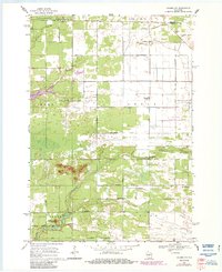
1968 Map of Coloma NW
USGS Topo · Published 1984About this map
Leola Marsh State Wildlife Area and the Big Roche a Cri State Fishery Area anchor this landscape, highlighting a region dedicated to conservation and water management. Located at the intersection of Adams, Portage, and Wood counties, the area is defined by its drainage networks, including Spring Branch and Fourteenmile Creek. A grid of rural avenues like Akron Drive and Apache Avenue connects the dispersed settlements of Rome, Leola, and Big Flats.
Find a feature on this map
32 named features on this map. Tap any name to fly to it.
Don’t see what you’re looking for? This feature index may not catch every label — zoom into the map to look around manually.
Map Details
Editions of this 1968 Coloma NW Map
2 editions found
Other maps of this area

1955 · Green Bay
USGS Topo · 1:250,000

1957 · Wisconsin Rapids
USGS Topo · 1:48,000

1957 · Whiting
USGS Topo · 1:48,000

1958 · Arkdale
USGS Topo · 1:48,000

1958 · Coloma
USGS Topo · 1:48,000

1967 · Roche A Cri
USGS Topo · 1:24,000

1967 · Arkdale NE
USGS Topo · 1:24,000

1967 · Wisconsin Rapids
USGS Topo · 1:62,500

1968 · Coloma NW
USGS Topo · 1:24,000

1968 · Coloma SW
USGS Topo · 1:24,000