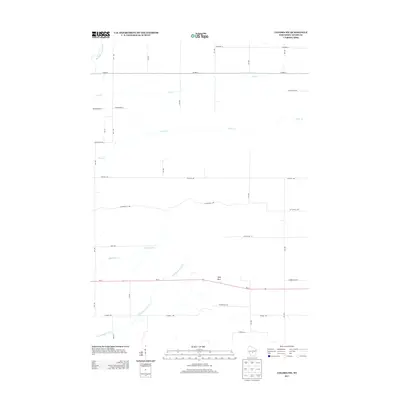
2013 Map of Coloma SW
USGS Topo · Published 2013About this map
Little Roche a Cri Cr and its tributaries carve a network of waterways through this section of Adams County, Wisconsin. The landscape is defined by the east-west orientation of major corridors like Wi-21 and Cottonville Ave, while a rigid grid of numbered avenues and drives, such as 8th Ave and 4th Ave, organizes the rural topography. A distinctive landmark in the southern reaches of the quadrangle is Ship Rock, rising above the surrounding terrain near the highway corridor. Small watercourses including Bingham Cr, Carter Cr, and Dry Cr crisscross the area, illustrating the drainage patterns of this Central Wisconsin region. The map reveals a transition where established county routes like Co Hwy-C meet local local roads, indicating a mix of regional connectivity and local land management.
Find a feature on this map
30 named features on this map. Tap any name to fly to it.
Don’t see what you’re looking for? This feature index may not catch every label — zoom into the map to look around manually.
Map Details
Editions of this 2013 Coloma SW Map
This is the sole edition of this map. No revisions or reprints were ever made.
Other maps of this area

1955 · Green Bay
USGS Topo · 1:250,000

1957 · Madison
USGS Topo · 1:250,000

1958 · Arkdale
USGS Topo · 1:48,000

1958 · Coloma
USGS Topo · 1:48,000

1960 · Madison
USGS Topo · 1:250,000

1961 · Oxford
USGS Topo · 1:62,500

1961 · Adams
USGS Topo · 1:62,500

1967 · Roche A Cri
USGS Topo · 1:24,000

1967 · Arkdale NE
USGS Topo · 1:24,000

1968 · Coloma NW
USGS Topo · 1:24,000