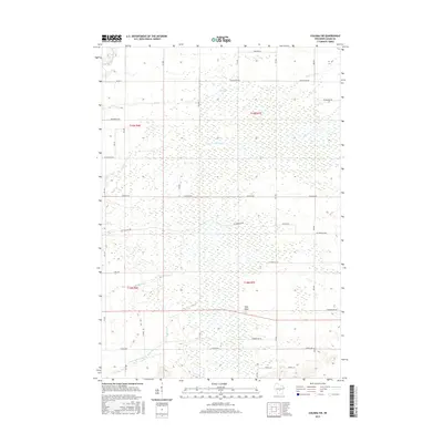
2015 Map of Coloma SW
USGS Topo · Published 2015About this map
Ship Rock rises as a prominent landmark in this section of Adams County, overlooking a landscape defined by the branching waterways of the Central Sands region. The drainage patterns of Big Roche a Cri Creek and Little Roche a Cri Cr dominate the southern portion of the quadrangle, while the northern terrain is crossed by the intermittent reaches of Dry Cr and Carter Cr. This 2015 data illustrates a rigid grid of rural corridors such as Chicago Ave and Cottonville Ave, reflecting the systematic township and range organization of t19n r6e, t19n r7e, t18n r6e, and t18n r7e. The map reveals a high density of wetlands and small water bodies scattered between these agricultural and timbered blocks, offering a clear view of the hydrological character of the area before modern development further altered the natural flow of Bingham Cr.
Find a feature on this map
26 named features on this map. Tap any name to fly to it.
Don’t see what you’re looking for? This feature index may not catch every label — zoom into the map to look around manually.
Map Details
Editions of this 2015 Coloma SW Map
This is the sole edition of this map. No revisions or reprints were ever made.
Other maps of this area

1955 · Green Bay
USGS Topo · 1:250,000

1957 · Madison
USGS Topo · 1:250,000

1958 · Arkdale
USGS Topo · 1:48,000

1958 · Coloma
USGS Topo · 1:48,000

1960 · Madison
USGS Topo · 1:250,000

1961 · Oxford
USGS Topo · 1:62,500

1961 · Adams
USGS Topo · 1:62,500

1967 · Roche A Cri
USGS Topo · 1:24,000

1967 · Arkdale NE
USGS Topo · 1:24,000

1968 · Coloma NW
USGS Topo · 1:24,000