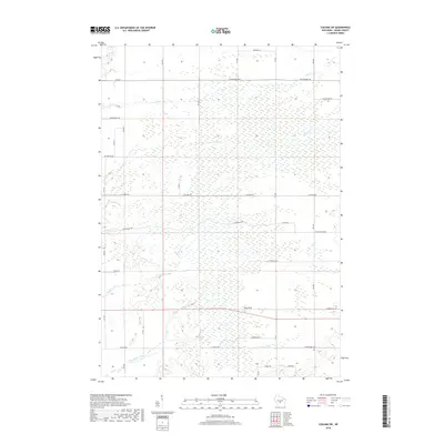
2018 Map of Coloma SW
USGS Topo · Published 2018About this map
The landmark known as Ship Rock stands as a primary elevation point within this Adams County landscape, situated near the intersection of several local thoroughfares. This central Wisconsin region is defined by a dense network of seasonal and permanent waterways, including the winding Little Roche a Cri Cr in the south and Carter Cr traversing the central portion of the survey area. The terrain exhibits the characteristic flat, sandy plains of the Big Flats area, where water features like Bingham Cr and Dry Cr influence the local drainage patterns. The road network is strictly gridded, with long east-west corridors such as Cottonville Ave and Chicago Ave providing access across the marshy and forested tracts. This layout reflects the systematic land division typical of the area's agricultural and rural residential development in the late twentieth and early twenty-first centuries.
Find a feature on this map
21 named features on this map. Tap any name to fly to it.
Don’t see what you’re looking for? This feature index may not catch every label — zoom into the map to look around manually.
Map Details
Editions of this 2018 Coloma SW Map
This is the sole edition of this map. No revisions or reprints were ever made.
Other maps of this area

1955 · Green Bay
USGS Topo · 1:250,000

1957 · Madison
USGS Topo · 1:250,000

1958 · Arkdale
USGS Topo · 1:48,000

1958 · Coloma
USGS Topo · 1:48,000

1960 · Madison
USGS Topo · 1:250,000

1961 · Oxford
USGS Topo · 1:62,500

1961 · Adams
USGS Topo · 1:62,500

1967 · Roche A Cri
USGS Topo · 1:24,000

1967 · Arkdale NE
USGS Topo · 1:24,000

1968 · Coloma NW
USGS Topo · 1:24,000