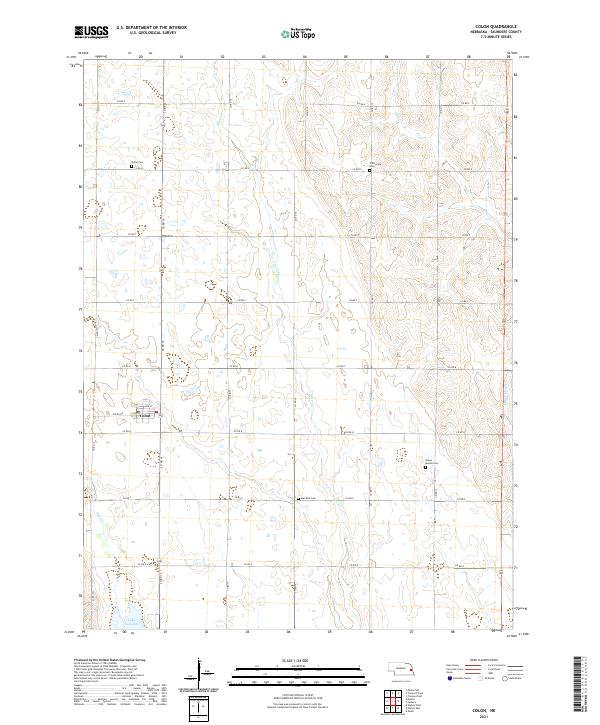
2021 Map of Colon
USGS Topo · Published 2021About this map
The village of Colon serves as the focal point for this agrarian landscape in Saunders County, Nebraska. Defined by a disciplined grid of section roads like Colon Rd and Oak St, the region preserves a high concentration of local history through its rural burial grounds. Genealogists can locate Union Cem, Platteville Cem, Marietta Cem, and Green Mound Cem, which anchor the surrounding farmsteads across the townships of t16n r7e and t15n r8e. Drainage throughout the territory follows the meandering paths of Silver Cr and Otoe Cr, while the southern edge is marked by the significant waters of Lake Wanahoo and Sand Cr. This survey illustrates the enduring intersection of Nebraska's structured land divisions and the natural watercourses that shaped early settlement patterns.
Find a feature on this map
30 named features on this map. Tap any name to fly to it.
Don’t see what you’re looking for? This feature index may not catch every label — zoom into the map to look around manually.
Map Details
Editions of this 2021 Colon Map
This is the sole edition of this map. No revisions or reprints were ever made.
Other maps of this area

1893 · Fremont
USGS Topo · 1:125,000

1896 · Fremont
USGS Topo · 1:125,000

1899 · Wahoo
USGS Topo · 1:125,000

1955 · Fremont
USGS Topo · 1:250,000

1957 · Fremont
USGS Topo · 1:250,000

1958 · Fremont
USGS Topo · 1:250,000

1968 · Leshara
USGS Topo · 1:24,000
1968 · Malmo NW
USGS Topo · 1:24,000
1968 · Fremont West
USGS Topo · 1:24,000

1968 · Fremont East
USGS Topo · 1:24,000