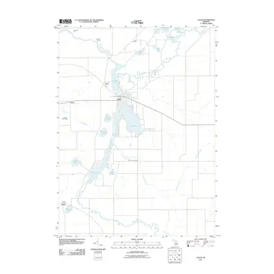
2011 Map of Colon
USGS Topo · Published 2011About this map
Palmer Lake and Sturgeon Lake dominate the central geography of this region, where the Saint Joseph River winds through the landscape. The village of Colon sits at the narrow junction between these water bodies, serving as a focal point for the surrounding rural area. Significant water features like Swan Creek, Little Swan Creek, and Colon Ditch illustrate the complex hydrography of the township. For genealogists, the distribution of several burial sites, including McAuley Cemetery to the north and South Colon Cemetery to the south, provides a clear view of early community clusters. The presence of the Colon Post Office and outlying settlements like Fairfax and Findley shows a established network of small Michigan communities tied to the river and the numerous glacial lakes such as Farrand Lake and Lepley Lake.
Find a feature on this map
28 named features on this map. Tap any name to fly to it.
Don’t see what you’re looking for? This feature index may not catch every label — zoom into the map to look around manually.
Map Details
Editions of this 2011 Colon Map
This is the sole edition of this map. No revisions or reprints were ever made.
Other maps of this area

1918 · Union City
USGS Topo · 1:62,500

1918 · Leonidas
USGS Topo · 1:62,500

1944 · Leonidas
USGS Topo · 1:62,500

1947 · Union City
USGS Topo · 1:62,500

1947 · Leonidas
USGS Topo · 1:62,500

1950 · Leonidas
USGS Topo · 1:62,500

1950 · Union City
USGS Topo · 1:62,500

1953 · Fort Wayne
USGS Topo · 1:250,000

1956 · Fort Wayne
USGS Topo · 1:250,000

1958 · Grand Rapids
USGS Topo · 1:250,000