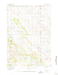
1957 Map of Colony
USGS Topo · Published 1973About this map
The Belle Fourche River meanders across this landscape where Wyoming, Montana, and South Dakota converge. The settlement of Colony serves as a local hub, supported by a specialized extraction economy evident in the numerous Clay Pits and the Bentonite Spur along the Chicago and North Western rail line. This industrial presence is balanced by a dense network of family cattle operations, including the Thorval Jensen Ranch, Newland Ranch, and Sloan Brothers Ranch. Education in this isolated ranching territory is anchored at the Baroid Sch, while an Airstrip near Chicago Creek facilitates travel across the Tri-State area. The mapping of landmarks like Mud Butte and Middle Butte suggests a topography defined by distinct elevations amidst the river drainage system, where water management is critical for survival as seen at Shepard Reservoir.
Find a feature on this map
52 named features on this map. Tap any name to fly to it.
Don’t see what you’re looking for? This feature index may not catch every label — zoom into the map to look around manually.
Map Details
Editions of this 1957 Colony Map
3 editions found

Other maps of this area

1901 · Aladdin
USGS Topo · 1:125,000

1903 · Aladdin
USGS Topo · 1:125,000

1905 · Indian
USGS Topo · 1:62,500

1907 · Belle Fourche
USGS Topo · 1:125,000

1907 · Redwater
USGS Topo · 1:62,500

1935 · Harding
USGS Topo · 1:125,000

1953 · Rapid City
USGS Topo · 1:250,000

1954 · The Forks
USGS Topo · 1:24,000

1954 · Lemmon
USGS Topo · 1:250,000

1954 · Ekalaka
USGS Topo · 1:250,000